Thursday, December 28, 2023

Doing Bird Dog Things

AlexHauck.Com

Seven Island State Birding Park / Kodak, TN  Saturday December 16, 2023 


I took the bird dog to a bird park and did bird dog things! This was a great park for Frank, with so much wildlife to see and look at. Seven Island is in a more urban setting and not as secluded and rugged as say Frozen Head but still extremely beautiful. This is the perfect place to take your pup for a long or short hike.  

- Click Here For AllTrails Hike Recording -

I missed one section I wanted to hit but still ended up with over eight miles by stringing all the trails together. On this one hike I saw three or four deer, a river otter, and many different bird species. There is one small section with some elevation to it, but most of the park is flat and easily hiked.  

Frank enjoyed this park so much that it might become one of our main places to go. He even let out a few of his bird barks and down along Seclusion Bend he got quite the echo back. He had such a fun time chasing and looking for birds and sniffing around in the large grasses and brush patches.  


They also have a boat launch to you could make an entire day out of hiking and paddling the French Broad River. Back in September we took a class on papaws at the park and paddled around for a bit. Incredibly beautiful.  

I would recommend going and checking it out. Take some binoculars, go at your own speed, and just take in the great outdoors.  

Story Links:

Pictures:


YouTube Video:


Wednesday, December 27, 2023

Fall 2023 Rich Mountain Loop

AlexHauck.Com

Great Smoky Mountain National Park
Sunday, October 22, 2023

The Rich Mountain Loop Hike is by far one of my favorite fall hikes in the Smoky Mountains. The trail does have some elevation to it so you have to work for it, but it offers some great colors in the fall. You can also tell the difference between the leaves at different stages of elevation on this hike.

I have hiked the trail in both directions, and for me it does not seem to make that much of a difference. I have heard people say clockwise is a bit easier, but I do not really think that is true. Being that his trail lies at the entrance of Cades Cove I have seen at least one bear on the trail each time I have hiked it but once. Please give them their space as it is their home.

Loop Trails:

·

Rich Mountain Loop Trail

............

0.50 Miles

·

Crooked Arm Ridge Trail

............

2.20 Miles

·

Indian Grave Gap Trail

............

2.60 Miles

·

Rich Mountain Loop Trail

............

2.90 Miles


Crooked Arm Ridge will be your first right had turn coming up to the trail sign after starting on Rich Mountain Loop for about a half mile. This trail has several switchbacks as you head up to the ridge. About a quarter mile up Crooked Arm, if it has been rainy, Crooked Arm Cascade will be just off trail to your right. If it has been dry there will not be much to look at if anything, but after a good rain it is a beautiful waterfall.


Close to the end of Crooked Arm and the beginning of Indian Grave Gap there will be a nice vista on your left. Most of the climb is over at this point and it will be easy going on the ridgeline. You will want to keep following Indian Grave Gap past Rich Mountain Trail until it intersects with Rich Mountain Loop. Along this ridgeline there will be a couple of opportunities to be able to see Townsend in the distance.

Photo Credit Mary Ellen Hauck

Rich Mountain Loop Trail will start your decent over some more switchback before it straightens out. Around seven and half miles into the hike you will come to John Oliver Cabin where you will normally run into a lot of people who usually stop the drive around the Cove to have a look. After that you are back into the forest and after passing a couple of shallow creeks you will be back to the start.


Again, this is a fantastic fall hike that you cannot beat for ease and leaf color during the fall. It is also a good winter hike as you can get to the Rich Mountain Trail if some of the park entrances are closed. As always my friends hike on, and stay safe out there.

Story Links:


Friday, December 22, 2023

Hiking Stiffknee to Slickrock

AlexHauck.Com

Cherokee National Forest / Nantahala National Forest
November 27-28, 2023


I took Monday and Tuesday off from work and headed out to the woods for a cold overnight. My adventure started off in Cherokee National Forest in the Citico Wilderness Area and ended up in Nantahala National Forest in the Joyce Kilmer-Slickrock Wilderness Area. I hiked down Stiffknee to the Stiffknee / Slickrock junction where I set up camp and then continued up Slickrock for a little while. After spending a frosty night in the woods, I then hiked back up Stiffknee. 

The Stiffknee trail I will breakdown into three sections; The Doozy, Wide Open, and Overgrown. Each had its positives and negatives, except for the wide-open portion that was just enjoyable all around. 


The Doozy:

If you are starting in Cherokee National Forest and you are hiking this one there and back the first and last 1.3 miles is not to be taken lightly. The elevation grade is steep! Not only is it steep but it is at an angle that makes footing and balance difficult. On the days I hiked the trail you can add in a lot of wet, slippery leaves and it makes it a little scary. There were couple of sections where a tree got uprooted and fell over taking parts of the trail with it so over these sections you will need to shimmy across. There were also a couple of super steep areas where on the way down I slid on my butt and on the way up I felt like I was alpine climbing. I had to push my trekking poles into the ground to hole my position then basically kick step or move the several layers of leaves and duff off the ground to I could get solid footing. This whole section was terribly slow going. 
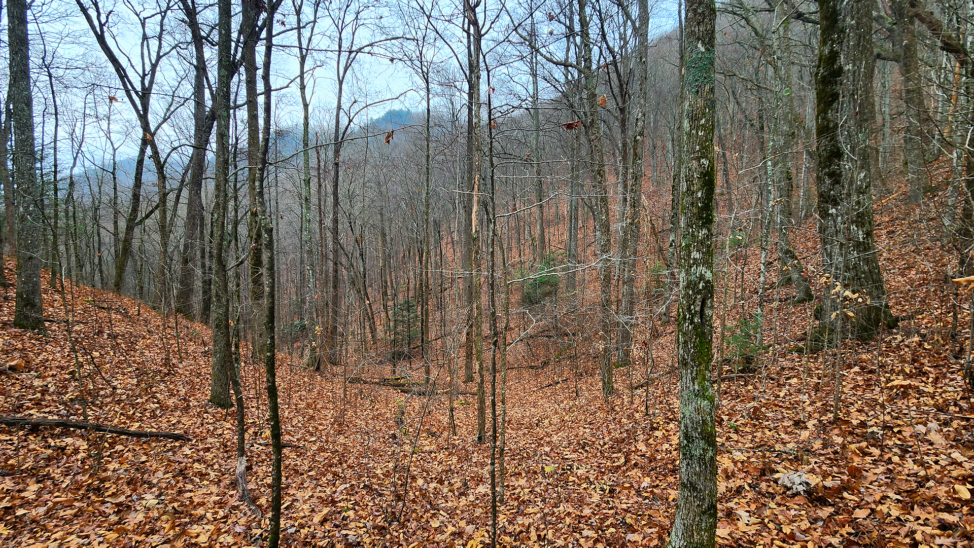

Wide Open:

This part of the trail was easy going and a very enjoyable hike. It was a forest environment that did not have any mountain laurel or thorns overgrowing the trail. It would be a nice spot to just do some off trail hiking and even set up a hammock for a day nap. The trail meets up with a creek for just an outstanding outdoor atmosphere.  


Overgrown:

This section of the trail, while not the fall to your death bad, is extremely overgrown even in cool weather when leaves are mostly gone. Briar patches, thorns, are all over this section and the trail gets lost in those sections along with mountain laurel. If it had been a warmer time of year, I would have just hiked the creek itself. It does open up a bit more once you get close to the junction with Slickrock Creek.  

Camp & Slickrock Creek:

There are several good campsites around the junction with Slickrock Creek and I set up in the Harold Parrish Upper Camp. The area is beautiful and the creek coming off Stiffknee flows into Slickrock that makes for a stunning view. Just a word of warning, if you are setting up camp and there is a possibility of high water make sure you are camping high enough to stay dry. 


I took down a good-sized dead tree that leaning of the camp area. When it came down it did land extremely near to the spot, I ended up putting my shelter for the night. I used a couple of longer limbs to put together a tripod that I hung my tarp in a plow configuration for the night. It workout well, I just wished the longer middle piece were a little straighter. When I left, I took the tripod apart and put it back in nature. I hope it will be there for me the next time but am confident it will become firewood. 

When I do this set up again, I will lay my sleeping back more centered and my head towards the outside. When I was sleeping my breath caused condensation to form on the inside of the tarp and freeze. It would melt when my sleeping back rubbed up against it and things got a little damp. It was a cold one, but I stayed warm all night and was never cold until I got up in the morning.


After getting camp situated, that took a little longer than I wanted, I decided to head up Slickrock Creek for a time. I was hoping to get the the lower falls but did not make it all the way there. I wanted to make sure I had enough light to make it back to camp. Even at the creek’s lower water level it is a scenic place and I look forward to coming back. There were several cascades where one could just sit, watch, and breathe while feeling the stress of life just vanish. I love water out in the woods. 

Back at camp I enjoyed a little time sipping a beverage and puffing my pipe on a rock watching the creeks collide together. Again, very peaceful and stress free. I fixed my meal of freeze-dried yellow curry with chicken along with hot tea and watched my new nightlight with its ambient fire setting. Since there was a burn ban, I could not have a real fire. 


I am hoping in early spring to make a loop out of this hike by combing Stiffknee to Slickrock to Big Stack Gap and finally Fodderstack. Then camp both at Slickrock and at the Crowder Branch spot I camped in this summer. I think it would be a fun and challenging adventure. Until the next one, hike on and stay safe! 

Bigfoot:

As most of you know I am a hopeful skeptic when it comes to the subject of Bigfoot. In all my outdoor activities and have not come across anything I would consider to be Bigfoot evidence until early this year when I was camping along Crowder Branch. I heard what sounded like tree knocks from one direction of my camp with a response from a different direction that sounded like the first. 

It did not sound like a tree and branch falling, woodpeckers or anything I normally associate with sounds coming from the woods. It sounded like a person taking a baseball bat to a tree. With that being said, I am keeping my eyes and ears open. 


This hike and camp are in the same general area and there are several Bigfoot related activities that pop up on the map over at The Bigfoot Mapping Project’s website. On this outing I did not notice anything nor hear anything, but it would be a great area to do a multiday expedition at. 

Hike Pictures:


YouTube Video:


Story Links:

Tuesday, December 5, 2023

Hiking at Norris Dam State Park

Rocky Top, TN 
Sunday, September 3, 2023 

Took Frank and headed up to Norris Dam State Park in Rocky Top, TN to explore some new ground. Below I have the route we took to put together a loop hike. It was a very easy-going trail, the only thing I did not realize was that it is a bike trail as well. All the bikers were very considerate except for one that almost ran over Frank. Luckily, I heard him, but he gave no warning and after passing me started to come back over to the side and did not see Frank standing there.

- Click here to go to Norris Dam Trail Map -

Our Route: (Distances on Approximates) 

1. 

Christmas Fern Trail 

....................... 

0.25 Miles 

2. 

Tall Timbers Trail 

....................... 

0.35 Miles 

3. 

Lake View Trail 

....................... 

2.30 Miles 

4. 

Pawpaw Trail 

....................... 

0.70 Miles 

5. 

High Point Trail 

....................... 

2.40 Miles 

You could even extend this hike further by not taking Pawaw and continuing with Lake View around to Hight Point. I also saw a hike on AllTrails that if you go off trail a little bit you can link up with some trail in the Norris Watershed Area.  


It is a fun hike I would do it again with Frank, but it is not what I would call awe-inspiring or anything. I would like to go and kayak the area and Clinch River Brewing is close by as well.  


Story Links: 


Abrams Falls & Rabbit Creek Loop

Trip Journal: Great Smoky Mountain National Park March 28 – 30, 2024  - Day One: Thursday March 28, 2024 -   I got off work at 16:00 and wen...