Showing posts with label Joyce Kilmer-Slickrock Wilderness. Show all posts

Monday, November 25, 2024

Slickrock & Citico Wilderness Loop

Cherokee & Natahala National Forest
November 15 - 17, 2024

The Adventure:

I have been eyeing this one for a little while now and decided to take a Friday off from work to get it done. I knew it was going to be a hard one but was planning to take my time to see it all. That would not be the case due to several issues that you can read in the next section, and I ended up having to bail.

AllTrails lists this hike at around twenty-two miles with some off shoots to see both mountain views and a waterfall. I no longer trust AllTrails so I decided to plot it out in Garmin Explore that is still new to me. I had all the trails written out correctly in my notes but when I plotted the route on the app, I made a mistake that would be the big reason I finally decided to bail. This hike was my first at stringing quite a few trails together that would be weaving in and out of two different National Forests that added to the complexity of the route. 

- Map of Hiking Area -

While the milage is not all that out of the realm for just a one-night two-day hike there is some profoundly serious elevation gain in sections. Another thing to account for is that National Forest trails are hardly maintained, so there will be obstacles to overcome along the route that will add to the time. 

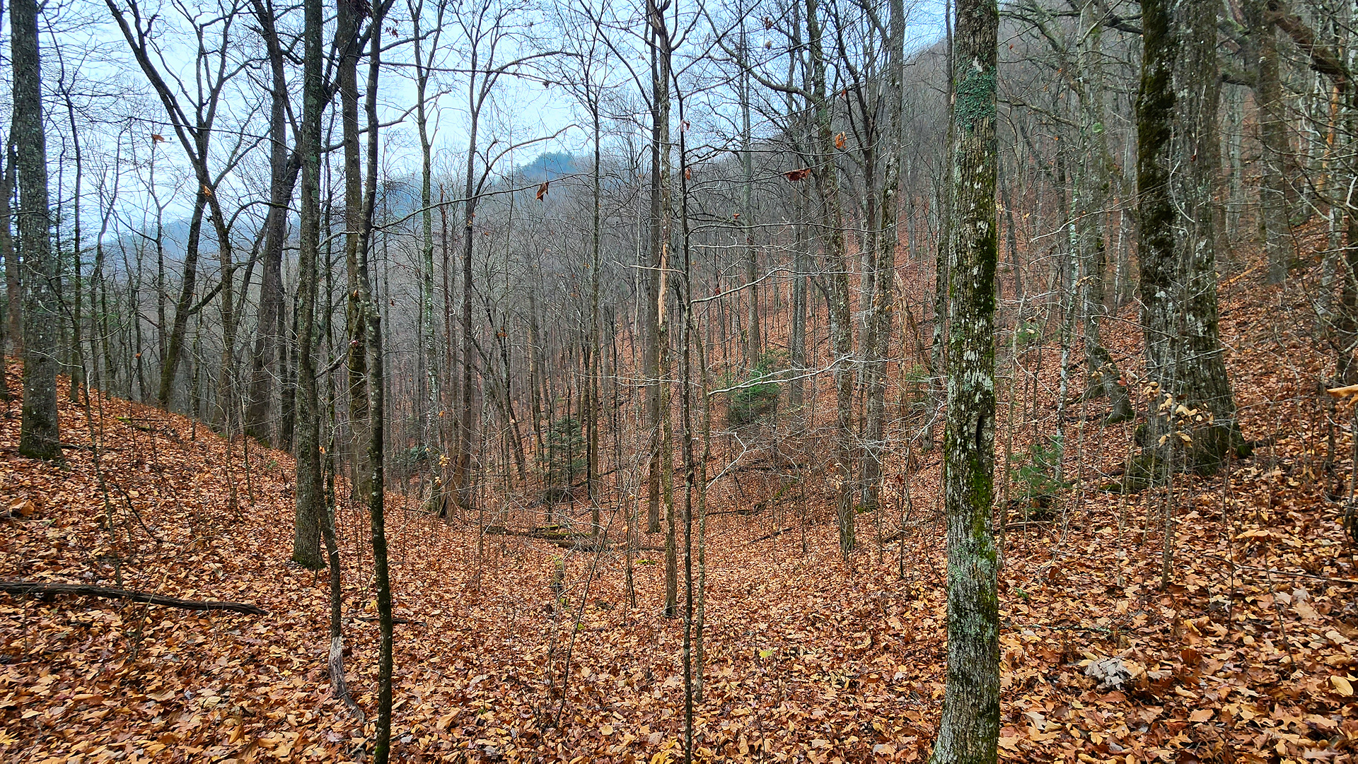
Thursday night and was tired. I got my food put together but instead of packing I decided to take it easy and relax a bit. I also slept in, packed up left however this did not put me on the trail until around 11:00 AM when I had planned to be on the trail around 7:30 AM – 8:00 AM. It was a very cool and overcast morning that gave the woods quite a Halloween / Lord of the Rings vibe, but the trail started out easy.


Then the elevation started, and it was a good workout hiking up to the ridge line. At about 5,000’ I was finally above the clouds and the sun peaked out. I stopped to have lunch to feel the sun, but if I only would have hiked on up for another minute, I could have had lunch at Straton Bald with a view to kill. Sometimes you win the lunch spot and sometimes you lose, and I lost this day. 


At this point, the day was getting away from as I had planned to camp by the creek at a lower elevation. Because that was my plan, I did not take a lot of water up to the ridge line and was figuring on making up time on the downhill portion of the hike. This backfired as the downhill had extremely steep grades with wet slippery rocks and leaves that slowed my pace to a crawl. To make matters worse it was too steep and narrow to camp and there was not any water around. Finally, just before twilight was over there was a suitable campsite but I still had to face the fact that I was not going to have a water source. With only a half liter of water left I had to stop and camp. There was no way of dealing with the steepness and slick trail in the dark. 

I had brought a steak to cook over the fire for the first night but that was not going to happen as without water around I did not really want to make a fire that I could not put out. I also did not want to use up the last of my water to warm up a dehydrated meal, so I snacked and went to bed. 

Day two started out with an early departure, some great sunrise views, and the hope that I would hit the creek area soon for water. Again, the level ground went away, and it was slow going on steep grades and took me about two and a half hours to get to water. I stopped had a little fire, ate, and hydrated. Probably should not have taken the time for the fire but it felt good.

Here at the bottom things flattened out and hiking felt good, and my pace was up. I really wanted to camp along the creek relax and not have to worry about water on the ridge, as this was my plan for the first night, but felt that I needed to keep going as it would be too far to hike out the next day. 

Just before the junction area of Big Stack Gap you can go up Slickrock Creek a little ways to Wildcat Falls, a beautiful little waterfall. I decided to take it as I missed the side trails yesterday and wanted to check it out. The trail is flat and beautiful with several good places to camp. I really wanted to camp here and will try to find time maybe next year starting at the North Slickrock Creek Trailhead and hiking down. This side adventure took time that caught up with me later. 


Once back on my main route is where my navigational mistake became a problem. I start up the trail but when I check my route plot it kept showing me going the wrong way. After some back and forth I sat down and took out the good old paper map and realized what I had done. When plotting the route out on Explore I mistook the boarder line of the two forests as the trails. This was going to add five or more miles onto my hike. I realized here that I may not be able to make it back to the Jeep the next day.

The Garmin InReach Mini is one of the best outdoor investments I have ever made, and it was a good thing I had it with me today. I knew the trail I had to take would put me up on Foderstack and the Crowder Branch junction. Crowder Branch was only a two-and-a-half-mile hike, so I faced the situation and contacted my wife to pick me up at the Crowder Branch trailhead. I really wanted to complete this one, but it would have been too much especially after the climb I was getting ready to have and the lack of water on the ridge. 


Getting to Crowder Branch was work and one of the hardest two miles of hiking in my life. Taking Big Stag Gap Branch was an extremely steep trail going from around 1,800’ up to 3,300’ in elevation in about a two-mile distance span. My pack weight, and lack of food was also starting to catch up with me and by the time I got to the top of the mountain I was just gassed. It felt so good rolling up to the little field along Crowder Branch and seeing I had it all to myself. 

Got my shelter setup and I wanted to make a fire so bad, but just did not have the energy. I made dinner and then had some tea with a lemon poppy seed bar before rolling up in my sleeping bag. This turned out to be one of the worse sleeps I have had solo in the backcountry. I could not shut my brain off while I kept dozing then waking up with a start. It also seemed that my heartrate would not go down to a resting level. 

I am sure this was due to all the hard hiking I was doing along with not enough food and being dehydrated. I finally had to concentrate on taking deep slow breaths and finally worked my way to sleep. After some decent rest I woke with a more clear head and filtered some water out of the mountain spring, made breakfast, packed up and headed down trail to meet the lovely wife. 


This trip, however, was not done with me. Crowder Branch trail was in some really bad shape this time around with more downed trees than I could count. I climbed, crawled, and army crawled my way down the trail. Finally after about two and half hours I cam out at the trailhead. 

This trip has made me really think and evaluate my methods. If I want to do more of these longer hikes I am really going to have to rethink how I backpack and become more focus on the “Type of” hike I am wanting to do. 

The blue trackway is how this hike ended up. Note I did fix the actual hiking route in red to the correct trail route.

What Went Wrong:

So, why did I fail on my intended route? Well, there are a few reasons for this happening. First, I do this more often than I would like to admit, but I underestimated the difficulty of National Forest trails. National Forest trails are not like National and State Park trails that are routinely cleared and maintained. These trails are overgrown, have many fallen trees, and a lot of the lessor used trails are almost non-existent. The amount of time it takes to navigate not only the obstacles, but also just staying on the intended trail is a lot and something I forgot to factor in. 

I am getting to the point in my hiking career, as it were, where I am going to have to start defining my objective of the overall hike. For instance, I am going to take my time and smell the roses, will it be more of a bushcraft camping trip, or am I going to cover a lot of miles? Right now, I am trying to combine all three and that is causing timing and packing issues. This hike was clearly putting on the miles and I should have treated it as such. 

I need to start double checking my route planning to make sure I know the trails and junctions I need along with some different routes if I need to shorten the hike. AllTrails has failed me so many times I no longer trust just it when I am hiking and am moving towards Garmin Explore. The problem on this occasion was when I moved my list of trails from the paper map that I wrote down I mistook the boarder of the two forests as the trail I needed. As you read from above in the end cost me the hike. 

The night before the hike I was tired, so I decided to relax the night before instead of packing and getting everything set up. That of course caused me to leave later than expected, which forced me to camp on the ridge, without water, instead of by the creek. It also put me behind schedule as I was planning on a 6-mile hike out on the third day. 

Day two was when I ran into my navigation mix up and I wasted a lot of time looking for a trail that was not there. Finally, I pulled out my paper map and realized the gravity of the mistake. This also caused me to run into another issue of being short on water. That eventually led to my decision to camp at Crowder Branch and have my wife meet me at that trailhead for the pickup.

Thankfully, I had a Garmin InReach Mini so I could schedule that, or I would have had to have a 10 plus mile hike back to the car. As slow as I was moving who knew how long that would take. It would have been late and with little to no water. This was a good lesson for me on future adventures. 

Story Pictures:


Related Posts:

Story Links:


Friday, December 22, 2023

Hiking Stiffknee to Slickrock

AlexHauck.Com

Cherokee National Forest / Nantahala National Forest
November 27-28, 2023


I took Monday and Tuesday off from work and headed out to the woods for a cold overnight. My adventure started off in Cherokee National Forest in the Citico Wilderness Area and ended up in Nantahala National Forest in the Joyce Kilmer-Slickrock Wilderness Area. I hiked down Stiffknee to the Stiffknee / Slickrock junction where I set up camp and then continued up Slickrock for a little while. After spending a frosty night in the woods, I then hiked back up Stiffknee. 

The Stiffknee trail I will breakdown into three sections; The Doozy, Wide Open, and Overgrown. Each had its positives and negatives, except for the wide-open portion that was just enjoyable all around. 


The Doozy:

If you are starting in Cherokee National Forest and you are hiking this one there and back the first and last 1.3 miles is not to be taken lightly. The elevation grade is steep! Not only is it steep but it is at an angle that makes footing and balance difficult. On the days I hiked the trail you can add in a lot of wet, slippery leaves and it makes it a little scary. There were couple of sections where a tree got uprooted and fell over taking parts of the trail with it so over these sections you will need to shimmy across. There were also a couple of super steep areas where on the way down I slid on my butt and on the way up I felt like I was alpine climbing. I had to push my trekking poles into the ground to hole my position then basically kick step or move the several layers of leaves and duff off the ground to I could get solid footing. This whole section was terribly slow going. 


Wide Open:

This part of the trail was easy going and a very enjoyable hike. It was a forest environment that did not have any mountain laurel or thorns overgrowing the trail. It would be a nice spot to just do some off trail hiking and even set up a hammock for a day nap. The trail meets up with a creek for just an outstanding outdoor atmosphere.  


Overgrown:

This section of the trail, while not the fall to your death bad, is extremely overgrown even in cool weather when leaves are mostly gone. Briar patches, thorns, are all over this section and the trail gets lost in those sections along with mountain laurel. If it had been a warmer time of year, I would have just hiked the creek itself. It does open up a bit more once you get close to the junction with Slickrock Creek.  

Camp & Slickrock Creek:

There are several good campsites around the junction with Slickrock Creek and I set up in the Harold Parrish Upper Camp. The area is beautiful and the creek coming off Stiffknee flows into Slickrock that makes for a stunning view. Just a word of warning, if you are setting up camp and there is a possibility of high water make sure you are camping high enough to stay dry. 


I took down a good-sized dead tree that leaning of the camp area. When it came down it did land extremely near to the spot, I ended up putting my shelter for the night. I used a couple of longer limbs to put together a tripod that I hung my tarp in a plow configuration for the night. It workout well, I just wished the longer middle piece were a little straighter. When I left, I took the tripod apart and put it back in nature. I hope it will be there for me the next time but am confident it will become firewood. 

When I do this set up again, I will lay my sleeping back more centered and my head towards the outside. When I was sleeping my breath caused condensation to form on the inside of the tarp and freeze. It would melt when my sleeping back rubbed up against it and things got a little damp. It was a cold one, but I stayed warm all night and was never cold until I got up in the morning.


After getting camp situated, that took a little longer than I wanted, I decided to head up Slickrock Creek for a time. I was hoping to get the the lower falls but did not make it all the way there. I wanted to make sure I had enough light to make it back to camp. Even at the creek’s lower water level it is a scenic place and I look forward to coming back. There were several cascades where one could just sit, watch, and breathe while feeling the stress of life just vanish. I love water out in the woods. 

Back at camp I enjoyed a little time sipping a beverage and puffing my pipe on a rock watching the creeks collide together. Again, very peaceful and stress free. I fixed my meal of freeze-dried yellow curry with chicken along with hot tea and watched my new nightlight with its ambient fire setting. Since there was a burn ban, I could not have a real fire. 


I am hoping in early spring to make a loop out of this hike by combing Stiffknee to Slickrock to Big Stack Gap and finally Fodderstack. Then camp both at Slickrock and at the Crowder Branch spot I camped in this summer. I think it would be a fun and challenging adventure. Until the next one, hike on and stay safe! 

Bigfoot:

As most of you know I am a hopeful skeptic when it comes to the subject of Bigfoot. In all my outdoor activities and have not come across anything I would consider to be Bigfoot evidence until early this year when I was camping along Crowder Branch. I heard what sounded like tree knocks from one direction of my camp with a response from a different direction that sounded like the first. 

It did not sound like a tree and branch falling, woodpeckers or anything I normally associate with sounds coming from the woods. It sounded like a person taking a baseball bat to a tree. With that being said, I am keeping my eyes and ears open. 


This hike and camp are in the same general area and there are several Bigfoot related activities that pop up on the map over at The Bigfoot Mapping Project’s website. On this outing I did not notice anything nor hear anything, but it would be a great area to do a multiday expedition at. 

Hike Pictures:


YouTube Video:


Story Links:

Brushy Mountain to Mt. Le Conte

Great Smoky Mountains National Park Saturday June 13, 2026  Blog Entry: There are six routes that take you up to the summit of Mount L...