Saturday, June 17, 2023

Wandering Along the Cumberland & Angel Falls

AlexHauck.Com

Big Southfork National River and Recreation Area
Friday, April 7, 2023

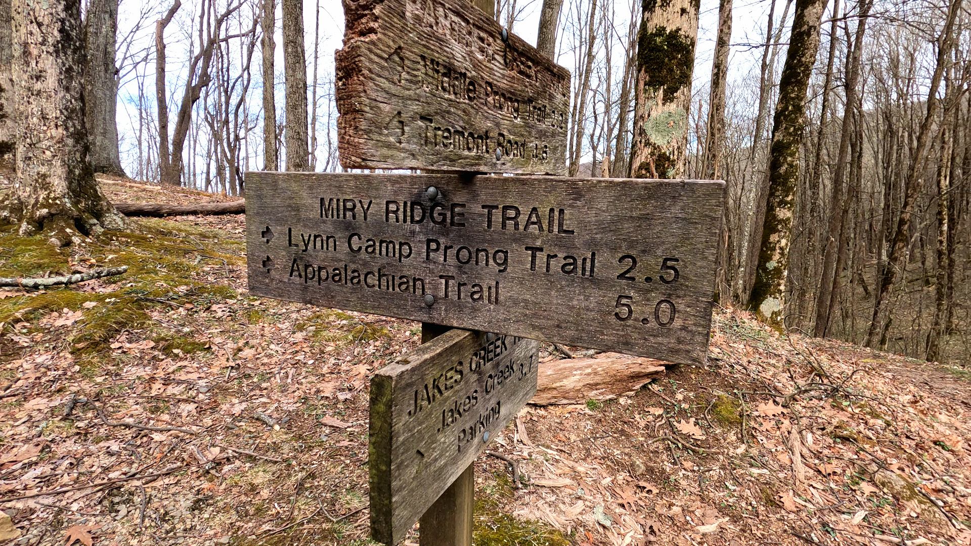
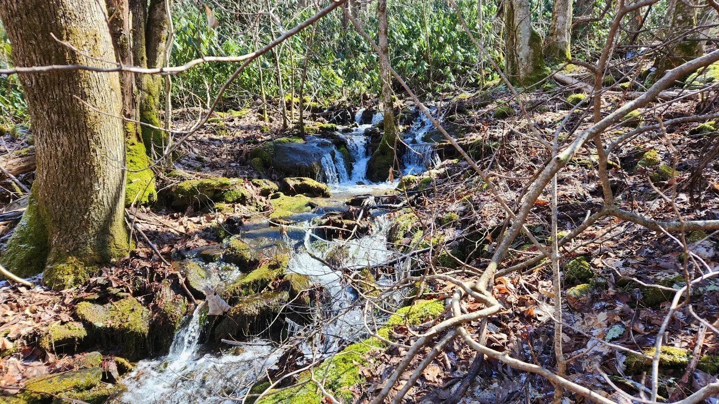
I was lucky enough to get Good Friday off this year, so I decided to spend it in nature. The forecast was calling for rain and I had two different hikes picked out. One was Sterling Mountain via Baxter Creek in the Smoky Mountains and the other one was Angel Falls Overlook in Big South Fork. I chose Angel Falls Overlook as the weather was predicting most of the rain moving east. Like most “weather predictions” it turned out to be wrong and followed me north. It rained on me for most of the day, but at least it did not turn out to be heavy.

US Topo Man of Hike Location

Saw a hike on AllTrails that takes the Angel Falls Overlook Trail then does a little loop before heading back down the Overlook trail. I really did not commit and decided to just follow it loosely and do a bit of wandering. This was nice for a change of pace as l usually always have a set route. This gave me a lot more flexibility and an opportunity to just relax. In the end I did the Angel Falls Overlook there and back then the Angel Falls Trail there and back that ended up being roughly fifteen total miles.

The Angel Falls Overlook Trail starts across the bridge from the trail head and peacefully follows the Cumberland River for a good chunk of the hike. At about the 2.5-mile mark you hit most of the elevation gain that lasts only for around a half mile or so. The bridge across the creek is currently out at the writing of this blog, so you will have to cross the creek to continue on this trail. After crossing the creek, the fun section of the hike begins as there are some stone shelves you hike around with the help of a cable and a ladder.

At this point it started to rain a little harder and there was a rock overhang just off the side of the trail, so I thought it would be a suitable time for a cup of Joe and a sandwich. With it being bone dry under the overhang I took my time and enjoyed my break. The Angel Falls overlook is about a five-minute hike from this point and is also close to the Grand Gap Loop trail junction. I would love to go back and complete the Grand Gap Loop trail as it rounds the whole plateau area.


The Overlook is beautiful and gives a spectacular view of the Cumberland River. The next time I go I need to remember binoculars as I could not make out where the rapid was at. If it were not for the rain this would have been a fine place to take my coffee break. It was here I decided to head back instead of doing the loop section of the hike as I wanted to see Angel Falls since I could not spot it from the overlook.

The Angel Falls hike is an easy 2.5-mile roundtrip that follows the Cumberland River the whole way. There are a few runoffs that create little waterfalls along the way and close to the rapid itself there are some interpretive signs about how to run them. Angel Falls rapid does look intense and it would be fun to watch people run it in real time.

After my trip out to Angel Falls, I took another short break along one of the runoffs and then headed back to the Jeep. This was a wonderful day and made me realize I need to do more of these loose style hikes. I am planning to come back to do the overview hike again and hike the rest of the Grand Gap Loop hopefully on a clearer day.

As always, my friends, Hike On and stay Safe!


 Story Links:

YouTube Video:


Tuesday, May 16, 2023

Hike Up Jakes Creek

AlexHauck.Com

Smoky Mountain National Park
March 11-12, 2023 


Trailhead and Ghost Town: 

I had yet to do the whole Jakes Creek Trail and decided it would be fun to hike it then stay overnight at backcountry campsite site #27. Jakes Creek located at the Elkmont Campground has sever interesting things to see at the beginning of the trailhead. There used to be a bunch of summer cottages for some of the wealthy Knoxville residents. Most of the old structures have been torn down but you will find some foundations and old stone chimneys that still stand. The park has done some restoration work to restore some of the homes so you can get an idea of what the community used to look like. (See Sources 1,2)  


At around a third of a mile you will reach the junction with Cucumber Gap. If you are looking for a short-day hike Cucumber Gap and Little River is a nice little loop hike that is around five miles. Just after Cucumber Gap you when then come to the Megis Mountain Trail junction and it is just under a half of a mile from here you will hit an unmarked side trail. 

Side Trail to the Avent Cabin: 

Hiking from Elmont around a mile and quarter up Jakes Creek on the right-hand side will be a side trail heading to the Avent Cabin. The trail is unmarked but there are a few actual steps that will lead you down to the creek and over a bridge. After crossing the creek, the side trail will angle to the right and up to the cabin.  


The Avent Cabin is one of the oldest structures in the Smoky Mountain National Park built around 1850 by the Ownby Family. It was then purchased in 1918 by Frank Avent who was married to the artist Mayna Avent who used it as a summer studio. It was eventually taken over by the National Park Service in 1932 but the family got a lease that finally expired in 1992. The cabin is registered as a national historic site. Below if you look at source not #4 the article has several examples of Mayna’s art along with a complimentary article. (See Sources 2, 3, 4, 5, 6) 

Back on the Trail: 

Once back on Jakes Creek you will continue your climb up, while not horrible, the elevation gain is quite substantial. The climb continues all the way to the top of Jakes Gap. Another quarter mile or so from the Avent Cabin side trail there is a most picturesque cascade or waterfall right before you get to a short switchback.  

After this short switchback, the trail gets a little steeper but there a several small, beautiful cascades as you climb. The creek will eventually switch back to the left side of the trail and will start to head away from the trail all together. After about another quarter to half mile I believe you will hit backcountry campsite #27.  

I decided to have lunch and pitch camp before I finished the hike. The campsite is pretty spread out and appears to have several self-made fire pits in a few different areas. There is an actual park fire ring at the first spot right off the trail by a large rock. The creek is a short hike down that makes for a plentiful water source. It is a nice campsite but does feel a little janky with spots here and there.  


Back on the trail it did not take long from campsite #27 to hit Jakes Gap and the trail junction with Panther Creek. I did the Panther Creek Lynn Camp Prong Loop a couple of years ago off Middle Prong and that was a fun hike. Hiking Jakes Creek and doing that loop then a stay at #27 or #26 along Mirry Ridge would be a nice overnight hike to do in the future. 


Back at camp I got my chores done and set in for a nice relaxing night. A few beverages, a campfire, and a beautiful evening transition into night was exactly what I needed for the soul. Sleep was good until early morning when the storms came in with some high winds. I could not really tell the winds were that strong in my tent, but I could hear the trees moving outside. I always have a little pucker factor when I hear the trees moving.  

When I finally got up the rain was still coming down at a good clip, so I decided to pack up in the tent. It finally slowed enough I was able to get a cup of coffee and finish packing without getting too wet. Another beautiful hike back to the Jeep and got to see two more deers out and about. This was not a bad hike at all, though you do have some elevation to deal with. The campsite has a couple of flat spots for tents, but I might hammock camp the next time. If you get out there or have been out there let me know what you think. As always, hike on and stay safe out there. 

Tuesday, April 18, 2023

Quick Overnight in the Smoky Mountains

AlexHauck.Com

Smoky Mountain National Park
January 27-28, 2023

I needed some time to relax and reset so I decided to head out after work on Friday and get a quick overnight in the mountains. On the Western boarder of the park by the Abram Creek campground off the Cooper Road Trail and under a mile hike is backcountry campsite #1. It is nestled next to an offshoot of Abrams Creek with plenty of flat ground for tents and trees for hammocks.  


The trail to the site has no real elevation so it is a quick hike and an excellent choice for a quick getaway after work. After getting set up whoever stayed there before me had left some firewood which was nice as I was able to get a fire going right away. Of course, I paid it forward and left a good stash for the next group.  


It was truly a relaxing night and the next morning I just hung out by the fire, had coffee, and made an egg and cheese beagle. Tore down camp, headed out, and made it home just after 11:00. Let me know have you ever done a quick overnight after work just to reset? Leave a comment and if you have not yet check out my website for more adventure videos and stories.  


Thursday, April 6, 2023

Mill Branch / Crowder Branch Loop Hike

AlexHauck.Com

Cherokee National Forest
Saturday, February 19, 2023

This trail is a doozy. Both Mill Branch and Crowder Branch are steep trails especially after the first little bit coming off Doublecamp Road. I have hiked Mill Branch before as an out and back and knew what I was getting into with that trail, but wanted to extend it this time so I put a loop hike together consisting of the following trails and forest service road… 

FS Trail #96 Mill Branch 

FS Trail #99 Fodderstack 

FS Trail #84 Crowder Branch 

FS Road #2659 Doublecamp  

AllTrails 3D Map of the route I took.
- Click Here For Recording -

I worked my way up Mill Branch that is a fairly well-defined trail until you get close to the end. It follows Mill Brach about to the top just before you hit the ridge and has several little waterfalls that make a pleasant walk to compensate for the work associated with the elevation. As you close in on the top, with the leaf cover on the ground and general landscape the trail becomes a little difficult to follow. The end of Mill Brach and the junction with Fodderstack, however, is not hard to find and stands out with a group of fallen trees by an aged trail marker.  

Fodderstack is easy to follow and follows a ridgeline. I hiked this one in February with low foliage and plant growth along the trail so I could see this section being overgrown in late spring and summer. Along this section of Fodderstack there was one good spot to get a beautiful view of the surrounding mountains.  

The trail junction with Crowder Branch is a little confusion as it spits into three different trails, but Crowder Branch picks up further down on what is listed as #139 Big Stack Gap Branch. If you turn left here, just a little further down the trail you will hit another junction for #84 Crowder Branch.  

Here there are two really good places to camp. One is at the first trail junction with Big Stack where there is a flat grassy area just along the trail. The downsides to this spot are that it is right on the trail, and you do have to walk a little way to get to the water source. The second spot is just past the second trail junction with Crowder Branch just before you hit the downhill section of this hike. It too is right on the trail, but it is not particularly traveled, and it is right next to a mountain spring for easy access to water. I am planning to do an overnight stay here soon.  

It is here at the second campsite that the trail gets confusing. I actually had to break out the map and compass to get my bearings and still think I missed the actual trail in several places. The area is extremely overgrown and the trail itself does not look well-traveled, so the path becomes unclear. As long as you stay close to Crowder Branch you should not get lost as the stream takes you all the way back to Doublecamp Road.  

I hiked in Crowder Branch for a time until I was able to pick up the trail again. Several sections of the trail are extremely narrow with a downward angle that makes it difficult even before you add the slippery leaves to the mix. I was planning to do a video for this hike but had Frank with me and at this point really had to stop filming to concentrate on not falling or getting lost. I do plan to put a video together when I go back for my overnight.  

It was this very angled section of trail I could not tell for sure if it was the actual trail, but it did look like some kind of footpath. As you get further down the trail becomes more well defined and you end up back at Doublecamp Road. 

To complete the loop, you will need to take Doublecamp road back to the Mill Branch trailhead. This really is not a bad walk, just watch out for traffic as in the summer months this area becomes busy. This was a fun hike with just enough “pucker factor” to keep one on their toes. I would not recommend this one if you do not have any experience with a map and compass. I would also say that in the summer months the trail will be a bit more overgrown with vegetation and it will be more difficult to find the trail. Get outside and hike safely my friends. 


Story Links:

- end -

Thursday, March 9, 2023

Slave Falls & Twin Arches Double Loop Hike

Big South Fork National River and Recreation Area
Friday, December 30, 2022

I had the day off from work, so I decided to take Frank and head up to Big South Fork National Recreation Area a place I need to do some more exploring in. The only other hike I have done in this area was the Honey Creek Loop that is a fantastic hike I would really recommend checking out.  

I should start out by stating that I found this trail system to be somewhat confusing both while hiking and on the maps. Trail names sort of run together and are not well marked however there were signs that pointed you in the direction of a location or feature. I was never lost, and the trails were easy to spot but especially from where I started out it was difficult to tell what trail you were hiking on.  


From what I could tell these were the trails and route I used: 

  • Fork Ridge ………………………………    0.2 Miles
  • Sawmill     ………………………………... 1.4 Miles
  • Slave Falls to Charit Creek ......   1.4 Miles
  • Twin Arches Loop ……………………    4.2 Miles
  • Slave Falls to Charit Creek ......   1.4 Miles
  • Sawmill     ………………………………... 1.4 Miles
  • Fork Ridge ………………………………... 0.2 Miles 

Another thing to note is if you view my AllTrails recording and use the map originally linked to the hike it goes off trail at one point by Slave Falls. This means if you are not willing to go off trail it will add some extra distance to your hike. Since Frank was with me on this hike, I had to go the extra distance as it is too hard going off trail with a leash.  

All being said, this is a great hike that is not very strenuous with beautiful nature filled landscapes and geological features. It is a wonderful place for a long day hike, and / or even a backcountry camp over a couple of days.  

I started at the Sawmill trail head and followed it north to what I believe is the Salve Falls Loop trail. I continued until I reached a side trail pointing you in the direction of Slave Falls. I thought I was there as the falls looked to be frozen hanging down off the cliff's edge. Come to find out later you need to continue around the cliff to reach the falls. I hiked back to the main trail and headed off in the direction of Needle Arch to which a sign pointed.  

Needle Arch
Needle Arch is a beautiful little arch that juts out of a larger rock formation and has moss growing on it. This is one of those features I could just sit down and look at for hours, but I had Frank with me who does not like taking breaks. After a few minutes we headed back to the trail and took the Slave Falls to Charit Creek Trail over to the Twin Arches Loop Trail. Along the Salve Falls to Charit Creek Trail there are a few nice spots to make camp. To be able to camp in the backcountry you will need to acquire a permit from Big South Fork.
  

Trail Head

Near Slave Falls

Needle Arch

Along the Trail

Me at the South Arch

Slave Falls

Click for AllTrails Recording


Once you hit the Twin Arches Loop Trail you will start to climb for a bit. On this trail there are huge rock faces for large tracks that are breathtaking. There also seems to be a lot of sandstone boulders laying around that over time looks like they do turn into sand on the trail. The Arches themselves are awe-inspiring and I will have to let the pictures speak for that as my words will not do it justice. Though I would also say that the pictures will not do them justice.  

Twin Arches - North Arch

After the arches, the trail starts to descend, and you will eventually reach Charit Creek Lodge. This is a beautiful little area where there used to be an old homestead. You will follow the trail north where you link back up with Slave Falls to Charit Creek again and following it the way you came.  

Twin Arches - South Arch

On my way back I found Slave Falls as there was a side trail I missed when I was heading the other direction. It was here on the AllTrails map I was following I noticed there was a small section of off trail that was hiked. If I did not have Frank with me, I would have figured it out, but a dog leash is not conducive for hiking off trail. The only thing to do was hike the long way around but it was also starting to get dark. Frank started to act a little panicked and was unusual for him, but I realized after that this was the first time, he was out with me on the trail when it was getting dark. Who knew a dog would get nervous because it was getting dark, not me.  

We just made it to the Jeep as the last of the daylight faded away. It was a great hike and a good day. Frank did some sleeping on the way home too!

3D Map of My Route - Click for Recording -

Story Links: 

  1. Big South Fork National River and Recreation Area
  2. AllTrails Recording
  3. YouTube Channel 
  4. www.alexhauck.com 
Video:


Climbing the Indian Staircase

Red River Gorge August 23, 2025 Note: I will be doing a full trip blog and video on my Red River Gorge weekend. Ever since Greg and I took a...