Thursday, November 10, 2022

Fall 2022 Frozen Head Hike

Frozen Head State Park
October 23, 2022  

I took Frank up to Frozen Head State Park for a fall hike and not going to lie it was one of the best fall hikes I have been on since moving to East Tennessee. The only one I would rate better was the Rich Mount Loop in the Smoky Mountains around the second year we moved down here. Today the weather was perfect with a slight breeze and crystal, clear blue skies. Since we have been in somewhat of a drought, the colors are not popping quite like usual, but they are still beautiful with most being a golden yellow with a few red ones worked in.  

When hiking in familiar locations I try to find new routes or tweak trails to make it a little different from previous hikes. On this hike I hit a new section of trail to make a loop just over ten miles. Below are the trails I hit to make this loop. 

(1)  North Old Mac …............ 3.55 miles 
(2)  West Lookout Tower …...  6.33 miles 
(3)  Flat Rock Story Book …... 0.45 miles  


The section of West Lookout Tower from North Old Mac to the Bird Mountain junction was a section I have not hit before. That section of the trail is not too bad and is part of an old dirt/gravel road with some pleasant views and nice places to stop and rest or snack. But the section that goes from the Bird Mountain junction to the campground is downhill with big rocks. That combination makes it really rough on the ankles and knees, especially with an overzealous dog like Frank. From the campground you can hit part of the Flat Rock Story Book trail to get back to the main trailhead parking lot.  


I have plans at some point to do the circumference of the park but will need to split that up for a day or two. I need to get out to some of the backcountry spots and scout out the water sources as sometimes water is hard to find in the park. Overall, this was a beautiful day and another great hike for the books. If you have not been out to Frozen Head, I would suggest checking it out at some point.  

 STORY LINKS - 

- PICTURES -


- HIKE VIDEO - 


Thursday, September 15, 2022

Solo Backcountry Camp

Cherokee National Forest
Friday, September 2, 2022 

Went out for a solo backcountry camping trip in Cherokee National Forest. Wanted to set up a bushcraft style camp, test out an A-Frame tarp setup, cook over a fire, and do some scouting of the area. 

A-Frame worked out well even though it did not look like my hammock bug net would work out. Still think a hammock setup is the way to go though I need to get an outer quilt. I also still need to practice some more getting a fire started with a ferro rod. With how wet things are in the area I camp char cloth or something else that will catch a spark easily will need to be added to my fire kit.  

I ran out of time to do any real scouting, so I am going to plan to go back as it gets a little cooler and some of the plant growth falls to make it easier moving. This area does look like a good place to find some solitude.  

I got a good fire going, had a great steak, but about halfway through dinner it started to rain. I did not get to make breakfast and coffee as the rain persisted through the morning. Still had a wonderful time and am ready to hit the backcountry again soon.

Story Links - 


- Pictures -


YouTube Video:


Monday, August 22, 2022

Hiking Mount Mitchell via Loop

Mount Mitchell State Park 
Saturday, August 13, 2022
 

This was such a fun hike with elevation changes, rock scrambling, views and more. Turned out to be an overcast and misty day for most of the hike but I did get some opportunities to see a view views of the mountains. Below are the trails I used to create the loop which basically boards Mount Mitchell State Park with some of the trails located in Pisgah National Forest. 

Here are the trails I used to make this loop: 

Commissary (MMSP) …………………………… 2.0 Miles
Buncombe Horse Range (PSN #191) …  2.4 Miles
Big Tom Gap (PSN #191a) …………………  0.4 Miles
Black Mountain Crest (PSN #179) ……… 1.5 Miles
Old Mitchell (MMSP)……………………………… 2.0 Miles 

MMSP = Mount Mitchell State Park
PNF = Pisgah National Forest 

3D Picture of my route through Mount Mitchell State Park

Parking at the park office I started off on the Commissary trail. The trail starts off as a graveled road and has a moderate descent and on a clear day there are several spots that provide great views. When you reach the Camp Alice trail junction Commissary switches from gravel to dirt. Just before you reach the junction with Buncombe Horse Range there are several nice backcountry campsites.  

Commissary trail turns into Buncombe horse Range and now you are in Pisgah National Forest. Most of this trail is under tree cover and you travel at a gradual incline but nothing hard at all. At least on the day that I hike the trail it was very saturated and appears it must be that way often. There were circular cut logs throughout to try and help people stay out of the muck.

When you hit Big Tom Gap / Pisgah National Forest Trail #191a is when the hike gets real. I knew a head of time that this section, while only 0.4 miles, was going to be a doozie. Most of the elevation gain on this hike is on this trail. There are sections that when muddy are supper slick and I feel it is easier going up this trail as opposed to down it. Hiking this today with all the fog and mist I really felt like I was in the Lord of the Rings book and at any moment I would have ring wraths on my tail. There are also a few rock scrambles on this trail as well.  

After climbing up Big Tom you reach the ridgeline and at this point the trail is call Deep Gap but actually starts off in Burnsville, NC as the Black Mountain Crest. I tried to hike this one a few months ago and had to turn around mostly because I was not going to have enough time. I plan to try this one again in the very near future.  
 

- Pictures -


The trail goes through several up and downs and you hit two summits above 6,000 ft. Before you even get to Mount Mitchell. Those are Big Tom at 6,580 ft. and then Mount Craig at 6,663 ft. There is a lot of rock scrambles at this point hard but extremely fun. You are also rewarded with sever nice views of the surrounding mountains.  

After you hit Mount Craig you go downhill for a little bit and then you start heading up and good incline. They do have stone steps to help you up however you are on natures stair mill. You will start hitting picnic areas that will open up to a parking lot. The summit is crowed with a lot of tourists since you can pretty much drive to the top. There is a gift shop and restaurant (snack) place and then you have just under a half mile hike up the summit trail to get to the top.  

Unfortunately, my wife’s luck rubbed off on me today and I was provided with a blanket of fog and not a real view from the top. I still enjoyed the whole experience and maybe I will get a better view after finally completing the Black Mountain Crest hike. After spending a little time on the summit I took the Old Mitchell trail that will be the final leg of my loop hike. 

While not the Black Mountain Crest this trail is pretty difficult in its own right. It is steep, there are rock scrambles, and it is currently under construction that makes extremely slick in spots. The trail hugs the road down the mountain and you get a forest vibe. You will hit the parking lot to the main restaurant where the trails pick back up on the other side. 

Extremely fun and challenging hike I would recommend this one. Also stay tuned for my second attempt at the Black Mountain Crest trail.  

Story Links:


YouTube Video
Hiking Mount Mitchell State Park via Loop


As Always Follow My Adventures At My Website


Thursday, July 28, 2022

Hike up to Mount Cammerer

The Smoky Mountains 
Saturday, July 16, 2022

Hitting a section of the Smoky Mountains I have neglected for some time I decided to finally get up to see the fire tower on top of Mount Crammerer. Mount Cammerer is in the Big Creek area on the North Carolina side of the national park. On this hike I did a there and back using the following trails...

Chestnut Branch................2.1 miles
Appalachian Trail..............3.3 miles
Mt. Cammerer Trail...........0.6 miles

Total Miles of hike............12.0 miles


Started on Chestnut Branch around 05:30 still in the dark. I know from on my way back that this is a very pleasant hike along the side of a creek. The elevation gain does start early on this hike and is constant until you get up to the Mount Cammerer Trail head. The last little bit of this trail up to the Appalachian Trial junction has quite the elevation to it, and it was at this point that the first light of the day started to creep over the mountains.


- PICTURES –


Heading west on the Appalachian Trail one continues to head up at a significant elevation gain. Trail crews at one time made steps out of dead trees but a lot of these have become washed out and have made the steps quite high in places. After about a mile you hit the junction with the Lower Mount Cammerer Trail that takes you to the backcountry campsite #35 and then on to the Cosby campground. Here I continued west and up where I heard something big moving about out of eyesight. I made some noise then I saw something brown moving in the bush. I couldn’t get a full look so it was either a bear or a turkey and with how heavy it sounded I would venture bear.

At about two thirds of the way to the Mount Cammerer Trail head you come to a rock outcropping with a fantastic view of the mountains. These views are hard to come by in the Smokies due to all the tree cover so I aways take some time to enjoy and take it all in. After this incredible view the trail becomes quite steep again finally evening out at the Mount Cammerer junction.

The Mount Cammerer trail is only about a half mile and leads you to the fire tower. It is a wonderful hike through mountain laurel tunnels and little rock scrambles which then drops you out in front of a small rock wall the fire tower sits on. The view from around the fire tower are amazing though the inside of the fire tower is a little less the desirable. With the structure sitting close to the Appalachian Trail you get a lot of hikers that use it as a shelter so there is a lot of rubbish lying about.

YouTube Video: Hike up to Mount Cammerer


As Always Check Out My Website


Friday, July 1, 2022

Frank Turner & Atlanta, GA Road Trip

ATLANTA, GA
JUNE 25 - 26, 2022

On Saturday June 25, 2022 the beautiful wife and I headed down to Atlanta, GA to see Frank Turner and the Sleeping Souls on their 50 States in 50 Days tour. Frank Turn is and has been my favorite music performer for quite some time. His songs have such meaning for me, and his sound is unique. The energy he brings to all his shows spill over to the crowd that creates such an electric atmosphere.


When I am on a road trip, you can expect that a brewery visit or two will be worked in as well. For lunch, we stopped at Cherokee Brewing & Pizza in Dalton, GA. They have plenty of beer on tap along with selections they brew on site. I had a fruity IPS that was good, and Mary Ellen liked their pilsner. The pizza was delicious, and we will stop by again if we go through Dalton.

After checking into the hotel, we then headed to Sweetwater Brewing for dinner. I had a couple of their Hazy IPA selections that we do not normally get up in Knoxville. Both were very good, and Mary Ellen liked their larger. We shared some nachos and decided that we were full. Sweetwater is a fun place, and the nachos and beer were outstanding.

From here, we headed to the concert hall that was the Tabernacle. It is a beautiful place and I think a great place for a concert. Beside some poles holding up the balcony there is not really a bad spot in the place. Frank and the Sleeping Souls rocked the house as always and the crowd was energized.

On the way home we stopped at stopped in at Red Top Brewhouse for brunch. We had a nice breakfast, and the Hikers Haven Triple IPA was fantastic. The only thing on this trip I wish could have happened was being able to spend a little more time at these nice places. Hopefully we will be back down this way to stop back by and find some new places as well.


As always check out my website for more Blogs,
Videos, & Features...


- PICTURES –


Tuesday, June 7, 2022

Black Mountain Crest Trail: After Action Report

Pisgah National Forest, NC
Friday May 27, 2022 - Saturday May 28, 2022


Not going to lie, this one was a total shit show from the very start that makes it even more disappointing as I was so looking forward to this hike for a very long time. I will start off by saying that I did do some research on the trail, but I don’t like watching videos beforehand as I like some sense of adventure when I go off on these hikes. I knew it was going to be grueling and tough, but I did not expect all the climbing and rock hopping I would be doing.  

Trail Map of the Black Mountains

I had planned to start his hike from the Bolens Creek trailhead get to the ridge and hike to Mount Mitchell then back. I was going to take my time with the first four miles as it looked to be a hard climb, and it was. Then I was going to pick up speed once I got to the ridge and get to Mount Mitchell then camp at Commissary Hill.  


I had multiple issues starting even before I left the house but did not know it until about two hours into my drive. I got up at 03:00 and left the house well before 04:00 that would have put me right on schedule to hit the trail around 07:00, but my GPS took me to Mount Mitchell State Park instead of the Bolens Creek trailhead. This re-route put me off my schedule by an hour. 

Once I got to the Bolens Creek location Google maps was off of course and I ended up in a backwoods neighborhood with tiny little dirt streets and no real good places to turn around. On a side note, there are some amazing houses back there literarily had waterfalls in their back yard. After my GPS failed, I got out my National Geographic topo map and after more driving around I could tell I was on the right road but still could not find a trailhead anywhere. I would eventually find out the National Geographic map did not have the next lower-level road systems on it. 

Now pushing 10:30 I decided on one last ditch effort and pulled the direction off my AllTrails app that I should had done from the very begging when I left the house. Turns out the trail head is down a “Private” road with a spot for maybe about two cars to park. National Forest trailheads are usually hard to find but with this being down a private road compounded the issue.  

Since it was so close to lunch I decided to go ahead and have a snack while gorging on some water. I knew the higher up the less likely I was going to be able to fill up. Around 11:30 I was finally on the trail and making some actual hiking progress. The first four miles of this trail is up, and I mean up. There are a couple of places the elevation because moderate but for the most part this section of the hike is steep around 700 plus feet per mile.  

Once you make it to the ridge the view opens to a magnificent view of where you can see all the peaks you will touch on the rest of the hike. Words cannot explain the beauty of it, and you realize just how much all that uphill was worth it. I was expecting to make up some time on this section of the hike but that was not in the cards. I knew with all the peaks there was going to be a lot of up and down but what I was not expecting was the rock hopping. It became apparent real fast that I was going to have to scramble, climb, and shimmy around rocks while facing some drop-offs in sections.  


Some places I needed both hands with not a good spot to set my tracking poles where they would not slide off the mountain. The wet conditions also made rocks a little slick and that slowed me down considerable. I came to a section where they placed a rope to help you climb and after shimmying around another rock then coming to another rope to climb down, I realized that I was not going to make this one.

I still had some distance before I would reach Deep Gap where I was planning to camp, then to get to Mount Mitchell and back to the car within the time I had allotted was just not going to happen. I decided to go back close to where I got to the ridgeline and camp for the night then make it back to the Jeep the next morning.  


I setup my hammock and tarp and as I started to warm up water for my meal a real dense, wet, misty fog set in. I ate dinner had some tea and did not even try to start a fire. I retreated to my hammock, laid down, and listened to an audio book. As I finally started to drift off the wind pick up and it sounded like a jet engine above me all night. The wind would blow and then throw down all the moister that accumulated on the trees above me. It even shook the trees I was attached to. 

In the morning when I woke up everything was just saturated. I did end up sleeping well as I was warm with the insulated pad and down sleeping bag. My body was never cold, but my hands froze with dampness from the equipment and the steady wind blowing through camp. I did not even try and make coffee I just packed and got started on the trail.  


Downhill was faster but still not an easy hike with the wet leaves made everything slick. Made it back to the Jeep around 11:00 and started the drive back home. I did not even get close on this hike, but I was safe, and I got to spend time outdoors so that was a win in the end.  

After thinking about this one the next time I try it again I need to get my pack weight down even more. Maybe just take a tarp, only take my cup and not a pot then cut town on some of my video/tech equipment. The other thing I will do is wait to fill up my water at the last creek stop about three miles up to cut down on the weight. Also, until I get the full scale of the whole trail, I will try to set up a shuttle and hike it only one way the next time. I still believe I can do a there and back, but I need to scout this out better. 


YouTube Video:


Tuesday, May 10, 2022

Bald River Falls Hike with Frank

Cherokee National Forest (Tellico Plains, TN)
Saturday, May 7, 2022 

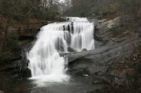
Bald River Falls and its trail is located in Cherokee National Forest in the Tellico Plains area. The waterfall is right off the road so that area usually has a crowd but most of the people stick close to the falls itself. While the falls attracts the crowd the trail is very well traveled too so it tends to be well maintained as national forest trails go.  

I like to take Frank on this hike because it is not overgrown and has the river running with it the whole way. The first section is steep with some switchbacks but after the initial climb flattens out and becomes very steady. There are several places along the trail ideal for backcountry camping and/or stopping for a snack. Makes for a great day hike with a lunch stop, that is if your dog will let you stop for lunch.  

I knew this would be a quick hike since I had Frank coming with me, so we took our time getting to the trail. Started out around 10:30 AM and it was cool with a steady rain. The day went back and forth from rain to mist and then back again though I never felt soaked to the bone. I do enjoy hiking in rain from time to time and today was one of those days. Frank started out his normal hyper self as it takes him about a half a mile before he will calm down but then settles into a pace, usually a fast pace.  

With the rain Bald River was roaring though I have seen it angrier but not my too much more. The river could be heard during the whole hike. Did not see much wildlife at all, but birds could be heard often that would set Frank off on a frantic search going side to side on the trail trying to find them.  
When we are out in nature Frank loves to get in the water however today I kept him out on most of the hike as the water was just moving too fast. I did find a little cove where the water was calm, and I let him doggie paddle for a little while.  
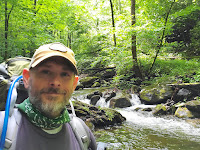
The trail ends at a Forest Service Road, so after a quick water stop, we headed back up the trail. Frank was gracious enough to give me a fifteen-minute snack break and he even had a few treats and then back at it again. Got back to the Jeep around 4:00 PM and for the first time ever I think Frank slept on the way home.

Check out my website for more adventures
www.AlexHauck.Com  

Hiking Bald River with Frank (YouTube)


Climbing the Indian Staircase

Red River Gorge August 23, 2025 Note: I will be doing a full trip blog and video on my Red River Gorge weekend. Ever since Greg and I took a...