Big South Fork River & Recreation Area
April 17 – 19, 2025
This was a fun one! I think I first saw the Needles Eye feature on an Instagram post but have since seen it in a couple of YouTube videos and knew I needed to see it for myself. I have yet to go backcountry camping up in Big South Fork and thought it would be a good time to get out there.
After doing a little bit of research I came to realize that there are not any “official trails” to find this feature. The map I have of Big South Fork is the National Geographic topographic map, and even a few of the major trails are not listed, so I turned to my arch enemy AllTrails.
 |
| - Leatherwood Trailhead - |
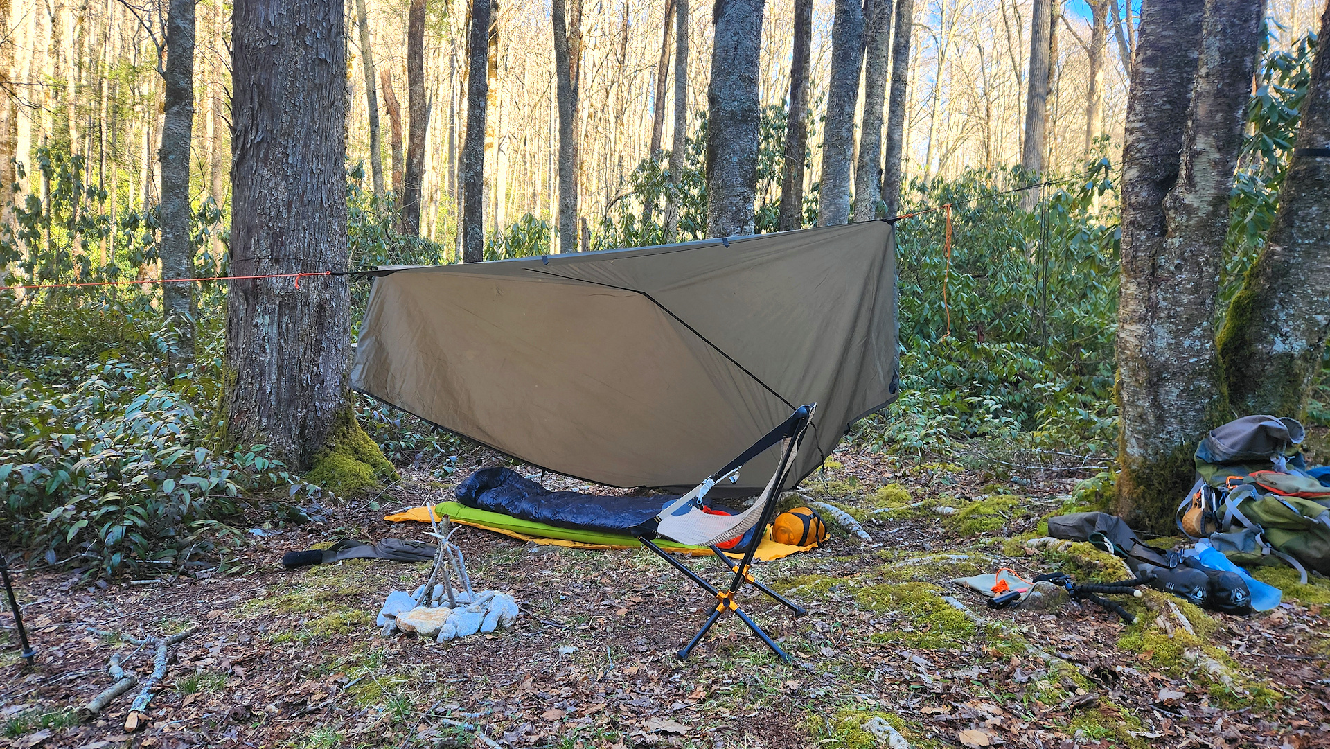
I decided for this one instead of setting up and tearing down camp each night, I would have a base camp for both nights. This would turn out to be a smart move, as I could just carry my day hiking kit instead of lugging everything with me. I decided to start up at the Leatherwood Trailhead and figured I could find a decent spot along the Cumberland River to set up and have a good water source. I left work on Friday and headed up where I hiked the John Muir trail for about a mile and found a nice sandy beach location to set up camp.
 |
| - View of the Cumberland River from my camp - |
The following morning after a quick breakfast and coffee, I was out on the trail the. taking the John Muir trail south along the Cumberland River is a very nice, easy hike. I love river views and mix in some of Big South Forks rocky features you have a lot to look at. When you get down to the old O&W train bridge you cross it and turn right to keep following the John Muir Trail. The Bridge will give you a great opportunity to view the Cumberland River.
 |
| - The old O&W Railroad Bridge - |
 |
| - Waterfall along the John Muir Trail - |
The trail then swings west and north for a bit, and you get to see another beautiful feature called Devil’s Den. It is a rock outcropping that formed a very shallow cave. I could see how this may have been used in the past for some moonshining, but that is just my guess.
 |
| - Devil's Den - |
As the trail swings back into a southernly direction you will come up on a junction. You will want to go right / west here as this is part of the Hurricane Loop trail that I found on AllTrails. This area seems to be a bunch of horse trails stitched together over time and have been given names by locals written on signs. I have not found any good maps of this area but there are several painted and handwritten signs that point you towards Needles Arch.
Just before you get to the arch there is a little spot with a picnic table and a cable to tie up any horses. To get down to the arch is a very short but narrow hike. Needles Eye is a wonder to see and with my limited writing ability I will never do it justice. When you get to the entrance there is a smaller arch within the larger one. There is a steep ledge once you get inside but they have a ladder so you can climb down and explore. The exit is rather large and leads to the side of the mountain, so you will have to leave the way you came in back up the ladder.
 |
| - Looking up the ladder to the Devil's Den entrance - |
This was an absolutely amazing trip, and I want to get back up to this area soon as there is more stuff to see. I may see if there are any good places to camp closer so I can cover more ground, but the little bit of the area I did see I don’t think there would be much water in the dry season.
As always my friends...hike on, and stay safe!

My map recording from AllTrails you can find it by clicking here. The southern most part of the track is where I realized that I made a wrong turn and had to double back.
Story Pictures:
 |
 |
 |
 |
 |
 |
 |
 |
 |
 |
 |
 |
 |
 |
 |
 |
 |
 |
 |
 |
 |
 |
|
|
Story Links:
- Big South Fork River & Recreation Area
- Backcountry Permit Site
- AllTrails: Recording | Profile
- Instagram Profile
- YouTube Channel